

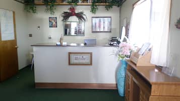
Hotel Alton
 Changez d’avisRéservez des hôtels avec annulation gratuite.
 Faites-vous plaisirConnectez-vous pour économiser 10 % ou plus sur des milliers d’hôtels.
 Trouvez votre bonheurFaites votre choix parmi près d’un million d’hébergements dans le monde entier.
Alton : optez pour un hébergement qui change de vos habitudes
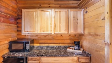
Appartement
Consultez les prix pour ces dates
Ce soir
Demain
Ce week-end
Le week-end prochain
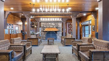
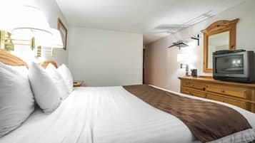
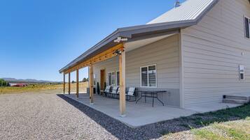
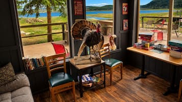
Alton : notre meilleure sélection d’hôtels
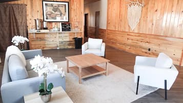


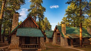
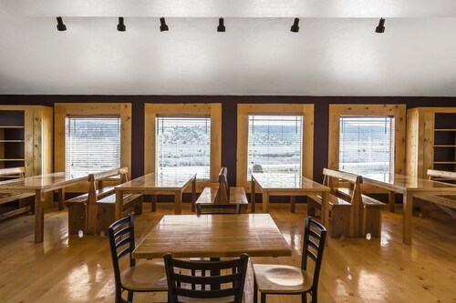
Bryce UpTop Lodge
Bryce UpTop LodgeBryce Canyon
7.0 sur 10, Bien, (985 avis)
« Très bon hôtel ! »

Luc
Le nouveau prix est de CHF 74
taxes et frais compris
20 juil. - 21 juil.


Bryce Canyon Pines
Bryce Canyon PinesBryce Canyon
8.0 sur 10, Très bien, (1 017 avis)
« Bonne chambre avec bel écran TV.
Bon Acceuil. Parking devant la chambre.
Piscine fermée en Avril à notre arrivée vers 17h. »

Pascal
Le nouveau prix est de CHF 65
taxes et frais compris
16 juil. - 17 juil.

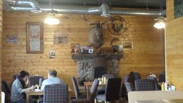
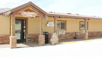
Hatch Station Motel and Restaurant
Hatch Station Motel and RestaurantHatch
8.6 sur 10, Excellent, (442 avis)
« Chambre petite mais très cosy.
Chambre très propre avec frigo.
Restaurant attenant au motel pour se restaurer de très bonne facture.
Accueil chaleureux.
Je recommande fortement ce motel. »
David
Le nouveau prix est de CHF 46
taxes et frais compris
16 juil. - 17 juil.

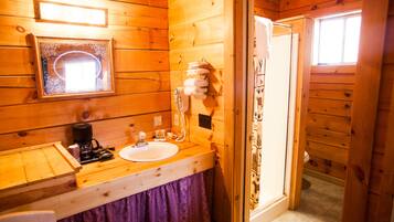
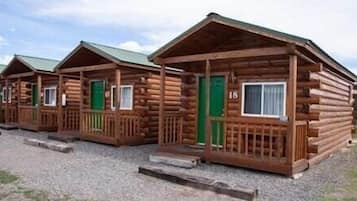
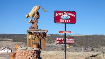
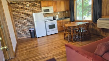
Bryce GatewayInn Cabins
Bryce GatewayInn CabinsPanguitch
7.8 sur 10, Bien, (880 avis)
« Séjour d’une nuit pour visiter Bryce Canyon.
Bien situé pour visiter le parc, ainsi que Red Canyon. Pas grand chose autour.
Correct, sans plus. »
Jérôme
Le nouveau prix est de CHF 59
taxes et frais compris
16 juil. - 17 juil.


The Lodge at Bryce Canyon
The Lodge at Bryce CanyonBryce Canyon
8.8 sur 10, Excellent, (112 avis)
Le nouveau prix est de CHF 197
taxes et frais compris
19 juil. - 20 juil.


Historic Smith Hotel B&B
Historic Smith Hotel B&BGlendale
9.2 sur 10, Merveilleux, (527 avis)
Le nouveau prix est de CHF 101
taxes et frais compris
16 juil. - 17 juil.


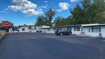
Rodeway Inn Bryce Canyon
Rodeway Inn Bryce CanyonPanguitch
8.0 sur 10, Très bien, (1 000 avis)
« Hôtel très pratique pour accéder à Bryce canyon, café à disposition très appréciable, restaurants très proche de l hôtel, personnel a l écoute,a recommander »
BRUNO
Le nouveau prix est de CHF 49
taxes et frais compris
26 juil. - 27 juil.


89 & Nine Motel
89 & Nine MotelOrderville
8.6 sur 10, Excellent, (208 avis)
Le nouveau prix est de CHF 81
taxes et frais compris
19 juil. - 20 juil.

Bryce Zion Inn
Bryce Zion InnHatch
7.8 sur 10, Bien, (555 avis)
Le nouveau prix est de CHF 47
taxes et frais compris
19 juil. - 20 juil.


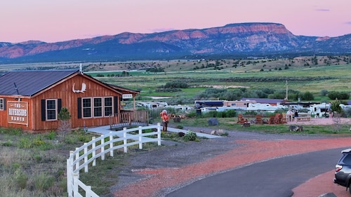
The Riverside Ranch RV Park, Motel & Campground
The Riverside Ranch RV Park, Motel & CampgroundHatch
9.2 sur 10, Merveilleux, (595 avis)
« Quel établissement. Le cadre est splendide. La propriétaire est charmante, sympa et plein de conseils.
Les chambres sont jolies et la vue incroyable.
Un petit paradis sur terre.
Le seul bémol est la literie avec un lit 2 places un peu petit.
Mis à part ça, c’est un pur bonheur et je n’ai qu’une envie, revenir à Hatch, au Riverside Ranch »
Pascal
Le nouveau prix est de CHF 85
taxes et frais compris
16 juil. - 17 juil.


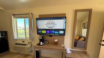

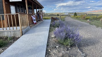
Mountain Ridge Cabins and Lodging
Mountain Ridge Cabins and LodgingHatch
9.2 sur 10, Merveilleux, (1 000 avis)
« Endroit très propre et accueillant »
Gaetan
Le nouveau prix est de CHF 104
taxes et frais compris
16 juil. - 17 juil.


Best Western East Zion Thunderbird Lodge
Best Western East Zion Thunderbird LodgeOrderville
9.2 sur 10, Merveilleux, (1 006 avis)
Le nouveau prix est de CHF 109
taxes et frais compris
16 juil. - 17 juil.


Arrowhead Country Cabins
Arrowhead Country CabinsMount Carmel
9.6 sur 10, Exceptionnel, (87 avis)
« We enjoyed our stay at Arrowhead Cabins. The owners are very sweet and helpful. The location was great for seeing the National Parks nearby. Callie and Laura were very informative on things in the area even pointing us to a unique "Americana" museum that was with the stop. Working farm gave us fresh hard boiled eggs each morning along with baked goods. »

Patti
Le nouveau prix est de CHF 167
taxes et frais compris
22 juil. - 23 juil.


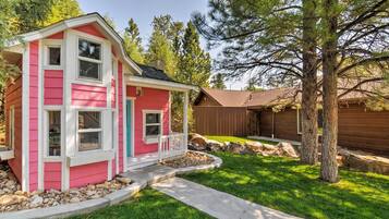
Galaxy of Hatch between Bryce and Zion
Galaxy of Hatch between Bryce and ZionHatch
8.4 sur 10, Très bien, (32 avis)
« Décoration originale de la chambre : Harley Davidson.
Patron à l'écoute.
Très bonne literie, très propre, chambre tres soignée.
Excellent emplacement entre Zion et Bryce Canyon.
Nous recommendons. »
Franck
Le nouveau prix est de CHF 66
taxes et frais compris
16 juil. - 17 juil.


Duck Creek Village Inn
Duck Creek Village InnDuck Creek Village
9.4 sur 10, Exceptionnel, (175 avis)
« Merci pour l'accueil, la chambre est très propre et la propriétaire très gentille. »
PASCAL
Le nouveau prix est de CHF 166
taxes et frais compris
19 juil. - 20 juil.


Red Canyon Village
Red Canyon VillagePanguitch
6.0 sur 10, (2 avis)
« We canceled .
It was a terrible location right on a busy hwy and RVs all over totally misrepresented on the web site
The manager said he canceled it on your end and I spoke with you virtual assistant who told me that the charges would be removed
Please expedite this matter
Thank you »
Peggy
Le nouveau prix est de CHF 136
taxes et frais compris
22 juil. - 23 juil.


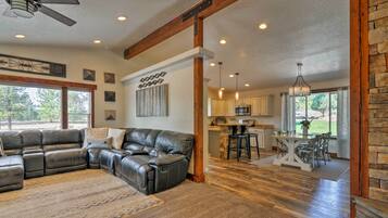
Between Bryce Canyon & Zion: Hiker's Paradise!
Between Bryce Canyon & Zion: Hiker's Paradise!Hatch
Le nouveau prix est de CHF 261
taxes et frais compris
16 juil. - 17 juil.


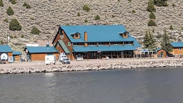
Aspen Cove resort
Aspen Cove resortPanguitch
7.0 sur 10, Bien, (68 avis)
« Great place to stay. Family owned. Fair priced. Incredible location for lake views, fishing and boat rentals. Will return and highly recommend.
»
Antonio
Le nouveau prix est de CHF 170
taxes et frais compris
17 juil. - 18 juil.


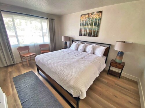
The Lodge at Duck Creek
The Lodge at Duck CreekMeadow View Heights
9.4 sur 10, Exceptionnel, (98 avis)
Le nouveau prix est de CHF 320
taxes et frais compris
22 juil. - 23 juil.


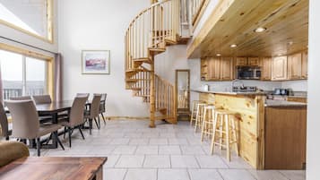
Luxe Home ~ 2 Mi to Bryce Canyon National Park!
Luxe Home ~ 2 Mi to Bryce Canyon National Park!Bryce Canyon
Le nouveau prix est de CHF 485
taxes et frais compris
1 août - 2 août
Prix par nuit le plus bas trouvé au cours des 24 dernières heures sur la base d’un séjour d’une nuit pour 2 adultes. Les prix et la disponibilité sont susceptibles de changer. Des conditions supplémentaires peuvent s’appliquer.

Connectez-vous et économisez 10 % ou plus sur des milliers d’hôtels
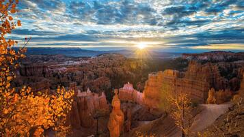
Séjournez à proximité d’attractions populaires à Alton
En savoir plus sur Alton
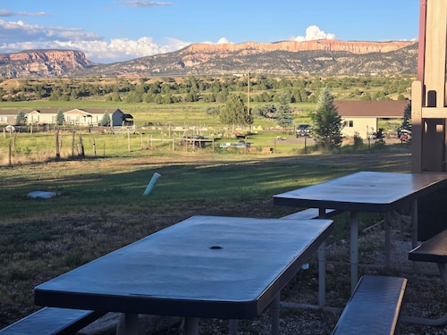
Alton vous offre des randonnées revigorantes, une faune sauvage fascinante et des aventures palpitantes !

Photo prise par Eric & Kristy's Adventures
Photo libre de droits prise par Eric & Kristy's Adventures


Séjours pas chers à Alton

Rodeway Inn Bryce Canyon
3090 UT 12 Panguitch UT
Le prix est de CHF 49 par nuit du 26 juil. au 27 juil..
CHF 49
26 juil. - 27 juil.
taxes et frais compris
8/10 Très bien ! (1 000 avis)


